


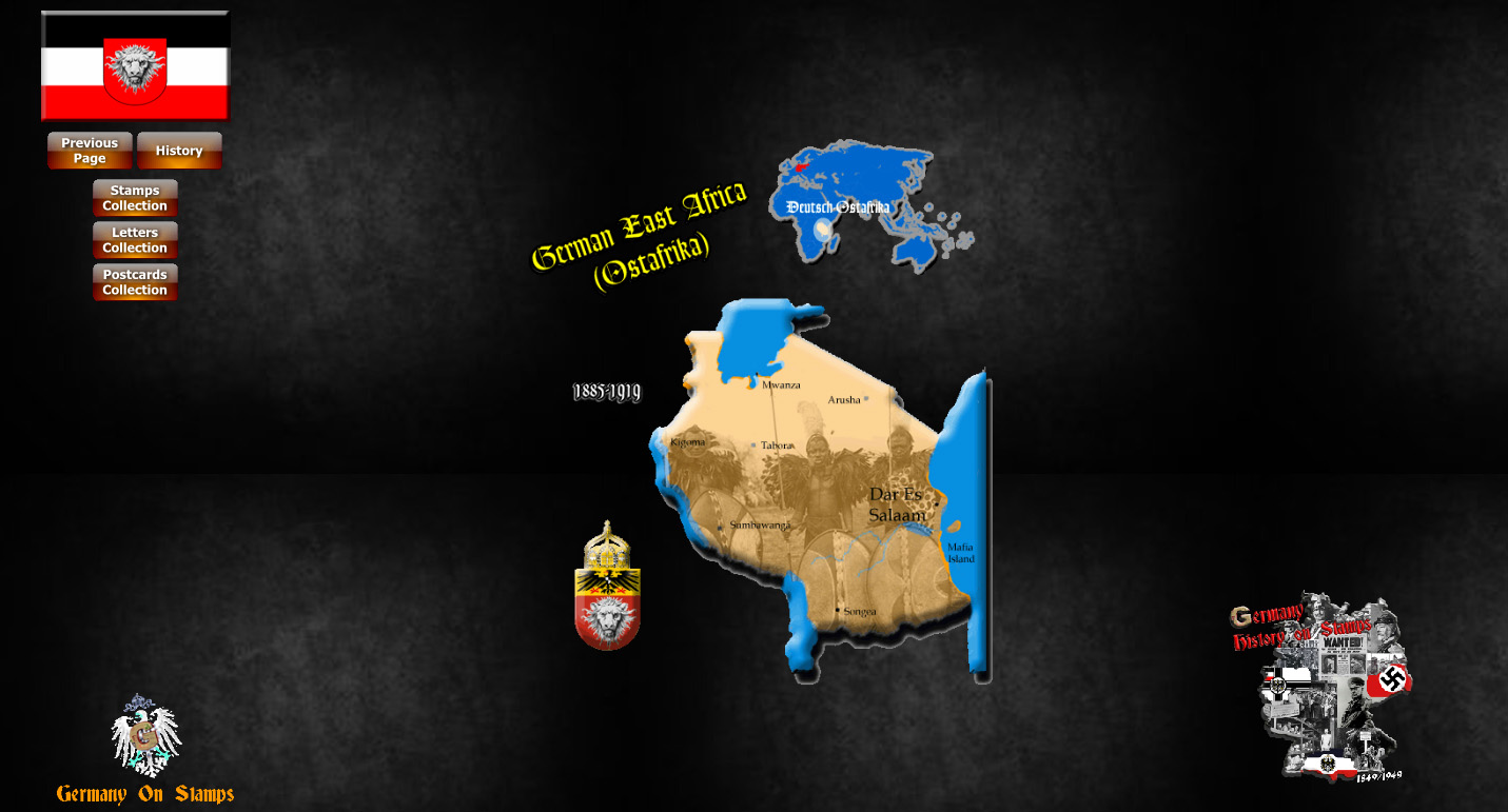
GERMAN EAST AFRICA
(OSTAFRIKA)
 // A Página Bilingue (Versões Inglesa e Portuguesa)")
 German East Africa (German: Deutsch-Ostafrika) was a German colony in East Africa, which included Tanganika (the mainland part of present Tanzania), Ruanda-Urundi (what are now Ruanda and Burundi) and Quionga Triangle.
German Occupation was on February 27, 1885, and ended with Imperial Germany's defeat in World War I. Afterwards the territory was divided between Britain, Belgium and Portugal by a mandate of the League of Nations.
Its area was 994,996 km² (384,170 square miles), nearly three times the size of Germany today.
History
 The colony began with Carl Peters, an adventurer who founded the "Society for German Colonization" and signed treaties with several native chieftains on the mainland opposite Zanzibar.
On 3 March 1885, the German government announced it had granted an imperial charter to Peters' company and intended to establish a protectorate in East Africa. Peters recruited specialists who began exploring south to the Rufiji River and north to Witu (Wituland), near Lamu on the coast.
When the Sultan of Zanzibar protested, since he claimed to be ruler on the mainland as well, Bismarck sent five warships, which arrived on 7 August and trained their guns on the Sultan's palace. With the Heligoland-Zanzibar Treaty, the British and Germans agreed to divide the mainland between them, and the Sultan had no option but to agree.
German rule was quickly established over Bagamoyo, Dar es Salaam, and Kilwa, even sending the caravans of Prince, Langheld, Emin Pasha, and Charles Stokes to dominate "the Street of Caravans".
 The Abushiri Revolt of 1888 was put down, with British help, in the following year. In 1890, London and Berlin concluded the Heligoland-Zanzibar Treaty, returning Heligoland (seized during the Napoleonic wars) to Germany and deciding on the borders of German East Africa.
Between 1891 and 1894, the Hehe tribe, led by Chief Mkwawa, resisted German expansion. They were defeated as rival tribes supported the Germans. After years of guerrilla warfare, Mkwawa himself was cornered and committed suicide in 1898.
The Maji Maji Rebellion occurred in 1905 and was put down by the governor, Count Gustav Adolf von Götzen. But scandal soon followed, with stories of corruption and brutality, and in 1907 Chancellor Bülow appointed Bernhard Dernburg to reform the colonial administration. It became a model of colonial efficiency and commanded extraordinary loyalty among the natives during the First World War. German colonial administrators relied heavily on native chiefs to keep order and collect taxes.
 German East Africa story's in the First World War is essentially the history of the colony's military commander, General Paul Emil von Lettow-Vorbeck, a vibrant officer, who spent the war harrying the forces of the British Empire. Lettow-Vorbeck was acclaimed after the war as one of Germany's heroes, and his Schutztruppe was celebrated as the only colonial German force in the First World War not to have been defeated in open combat. The Askari colonial troops that had fought in the East African campaign were later given pension payments by the Weimar Republic and the Federal Republic of Germany (West Germany).
The German East Africa Defence troops were able to withstand enemy forces for a long time into the war, but German East Africa was nevertheless completely occupied by the allied troops of Anglo-Indians, Belgians and Africans in late 1917.
The Treaty of Versailles broke up the colony, giving as a mandate the north-western area to Belgium as Ruanda-Urundi, the small Quionga Triangle south of the Rovuma River to Portugal to become part of Mozambique, and the remainder to Britain, which named it Tanganyika.
Postal history in German East Africa
German postal services in German East Africa started on October 4, 1890. However, prior to the Heligoland-Zanzibar Treaty, German postal offices were briefly in operation at Lamu in November 22, 1888 to March 31, 1891, and Zanzibar in August 27, 1890 to July 31, 1891. They were only in use for a short time and only had German Empire stamps.
Both postal agencies were given up with the Anglo-German Heligoland-Zanzibar treaty.
Gradually, during World War I, more and more parts of the colony were occupied by British, Belgian and Portuguese forces who issued their own stamps.
EAST AFRICA TERRITORIES AND THE TREATY OF VERSAILLES

With the defeat of Germany in WWI and in accordance with Article 22 of the Treaty of Versailles, the territory of German East Africa was divided and assigned under mandate from the League of Nations, as follows:
- United Kingdom controlled the territory of Tanganyika;
- Belgium gained Ruanda-Urundi in north-western of German East Africa;
- Portugal received the Quionga Triangle.
Tanganyika Territory
 After the war had broken out, the British invaded the German East Africa, but were unable to defeat the German Army.
The German leader in East Africa, Paul Emil von Lettow-Vorbeck did not surrender until the German Empire had collapsed.
Hereafter, the League of Nations gave control of the area to the United Kingdom who named their part of the earlier German area Tanganyika. The United Kingdom held Tanganyika as a League of Nations Mandate territory until the end of the Second World War after which it was held as a United Nations Trust Territory.
Brief History
In 1885 Germany declared that it intended to establish a protectorate, named German East Africa in the area, under the leadership of Carl Peters.
When the Sultan of Zanzibar objected, German warships threatened to bombard his palace. Britain and Germany then agreed to divide the mainland into spheres of influence and the Sultan was forced to acquiesce.
After charges of brutality in the repression of the Maji Maji Rebellion of 1905, and reform under the leadership of Bernhard Dernburg in 1907, the colony became a model of colonial efficiency and commanded extraordinary loyalty among the indigenous peoples during the First World War.
The German educational programme for native Africans, including elementary, secondary and vocational schools, was particularly notable, with standards unmatched elsewhere in tropical Africa.
 After the defeat of Germany in 1918 in World War I, under the Treaty of Versailles, German East Africa was divided among the victorious powers, with the largest segment being transferred to British control (except Ruanda-Urundi which went to Belgium, and the small territory of the Quionga Triangle, returned to Mozambique, then a Portuguese colony). A new name was needed, and Tanganyika was adopted by the British for all of its part of the territory of German East Africa.
In 1927, Tanganyika entered the Customs Union of Kenya and Uganda, as well as the East African Postal Union, later the East African Posts and Telecommunications Administration.
Cooperation expanded with those countries in a number of ways, leading to the establishment of the East African High Commission (1948–1961) and the East African Common Services Organisation (1961–1967), forerunners of the East African Community.
In 1961 after elections, Tanganyika is no longer a British colony, achieving its independence in December of that year. In 1964 Tanganyika was attached to the Island of Zanzibar to form Tanzania.
Ruanda-Urundi Territory
In the First World War, Ruanda-Urundi was conquered by forces from the Belgian Congo in 1916.
The former German colony was a Belgian suzerainty from 1916 to 1924, a League of Nations Class B Mandate from 1924 to 1945 and then a United Nations trust territory until 1962, when it became the independent states of Rwanda and Burundi.
Brief History
 The independent Kingdoms of Rwanda and Burundi were annexed by Germany along with the other states of the Great Lakes region in the late nineteenth and early twentieth century. Attached to German East Africa, the region only had a minimal German presence.
In the First World War, the area was conquered by forces from the Belgian Congo in 1916. The Treaty of Versailles divided German East Africa with the vast majority known as Tanganyika going to Great Britain. The westernmost portion, which was formally referred to as the Belgian Occupied East African Territories went to Belgium. In 1924, as the League of Nations issued a formal mandate that granted Belgium full control over the area. The territory officially became Ruanda-Urundi.
To implement their vision, the Belgians used the indigenous power structure. This consisted of a largely Tutsi ruling class controlling a mostly Hutu population. The Belgian administrators believed in the racial theories of the time and convinced themselves that the Tutsi were racially superior.
, consisting mainly of African soldiers, fought in Ruanda-Urundi during the First World War") While before colonization the Hutu had played an extensive role in governance. The Belgians simplified matters by stratifying the society on racial lines. The anger at the oppression and misrule among the population was largely focused on the Tutsi elite rather than the distant colonial power. These divisions would play an important role in the decades after independence.
While before colonization the Hutu had played an extensive role in governance. The Belgians simplified matters by stratifying the society on racial lines. The anger at the oppression and misrule among the population was largely focused on the Tutsi elite rather than the distant colonial power. These divisions would play an important role in the decades after independence.
After the League of Nations was dissolved, the region became a United Nations trust territory in 1946. This included the promise that the Belgians would prepare the areas for independence, but the Belgians felt the area would take many decades to ready for self rule.
Independence came largely as a result of actions elsewhere. In the 1950s an independence movement arose in the Belgian Congo, and the Belgians became convinced they could no longer control the territory. In 1960, Ruanda-Urundi's larger neighbour gained its independence.
After two more years of hurried preparations the former colony became independent on July 1, 1962, broken up along traditional lines as the independent nations of Rwanda and Burundi. It took two more years before the government of the two became wholly separate.
The Quionga Triangle Territory
The Quionga Triangle (German: Kionga) was a tiny territory on the border between German East Africa (largely overlapping the present-day United Republic of Tanzania) and the Portuguese colony of Portuguese East Africa, present day Republic of Mozambique.
The resurgence of Mozambique, stagnant for centuries, was marked in 1891 by fixing the boundaries of the colony. Faced with the north east and ambitious German colony, Germany signed, with a few days apart, two treaties, which recognize different boundaries at the mouth of the Rovuma River.

Dragged on until lengthy diplomatic negotiations in 1894, the Governor of German East Africa dawn the flag of your country in Quionga Bay, the only town of importance, the so-called triangle Quionga, which had an approximate area of 450 km2 of land valuable for irrigating rice fields and palm trees, valued for covering the south bank of the mouth of the Rovuma, leaving the entrance of the great river border into the hands of Germans.
The Germans established this outpost south of the Rovuma River, giving to Germany the effective control of its mouth into the Indian Ocean.
The declaration of war from Germany to Portugal was known in Mozambique on March 9, 1916. Following the declaration of war, the Portuguese army, commanded by Lieutenant Colonel José Luis Mendes de Moura return to reoccupy the Quionga Triangle. On the day before of the arrival of the Portuguese forces the Germans had abandoned Quionga and passed to the north bank of the Rovuma.
After several failed offensives perpetrated by the Portuguese army against the invading German forces, only with the Armistice of Compiègne, signed on 11 November 1918 between the Allies and Germany, the German came to end hostilities and finish the First World War.
The Portuguese campaign in Mozambique was a considerable portion of the Allies in the struggle for the conquest of German East Africa, although unfavourable circumstances had diminished the brightness of the first operations carried out in Germany by troops improvised, and had undermined the efficiency of Indian troops, hastily recruited and educated, with graduates in large numbers, without colonial experience.
After the First World War, the Treaty of Versailles set the border back along the Rovuma River. The Allies recognized Portugal as the rightful owner of the territory Quionga Triangle, been officially reinstated in Mozambique, September 25, 1919.
With the independence of Mozambique, 25 June 1975, the Triangle Quionga remained under his control as part of the province of Cabo Delgado.


0 comentários:
Post a Comment